| From | MN Department of Natural Resources <[email protected]> |
| Subject | Minnesota DNR news releases |
| Date | April 14, 2025 7:22 PM |
Links have been removed from this email. Learn more in the FAQ.
Links have been removed from this email. Learn more in the FAQ.
April 14, 2025
header
*Minnesota DNR News
*
*FOR IMMEDIATE RELEASE
*
April 14, 2025
*For more information:* <[email protected]>
Contact the DNR Information Center
by email <[email protected]>or call 888-646-6367.
In This Issue
* DNR Fish and Wildlife Almanac [ #link_1491411839600 ]
* Free entrance to Minnesota state parks and recreation areas on Saturday, April 26 [ #link_1491411977526 ]
* North Shore state park and hiking trail nominated for awards [ #link_1491412003165 ]
* Well sampling planned for Dakota County Groundwater Atlas [ #link_1 ]
________________________________________________________________________
DNR Fish and Wildlife Almanac
"A weekly list of news briefs about fish, wildlife and habitat management."
Get fishing questions answered on DNR fishing webpage
The Minnesota Department of Natural Resources has a fishing webpage [ [link removed] ] (mndnr.gov/fishing) to help answer angler questions. The page answers questions like:
* What species can I fish for?
* What kind of bait is legal?
* What kind of fish can I keep?
The page is a mobile-friendly destination for information on when, where and how to fish. Users will find links to LakeFinder, which provides maps and detailed information on lakes throughout the state, and the StreamFinder tool that provides a description, species list, regulations, and access information for trout streams throughout Minnesota.
DNR announces temporary, seasonal fishing closures
To protect spawning fish, the Minnesota Department of Natural Resources has begun to close certain portions of some Minnesota waters. The closings are routine and based on local conditions.
Closings happen each year as ice-out begins and waters begin to warm. The DNR closes the spawning locations to fishing only where habitat is limited and fish are very concentrated in one location, such as a river or the bay of a lake where fish are congregated during spawning.
Areas closed to fishing are listed and updated on the Minnesota DNR website [ [link removed] ]_ _(mndnr.gov/regulations/fishing/fishing-seasonal-closures.html). Portions of waters closed to fishing also are posted at access sites and in other visible areas. Anglers may fish in areas that are not posted.
Minnesota DNR hosts webinar on enjoying spring ephemerals
The Minnesota Department of Natural Resources invites people interested in wildlife and outdoor skills to check out the spring program schedule for the Minnesota Outdoor Skills and Stewardship webinar series.
On Wednesday, April 23, learn about spring ephemerals. These tiny, early blooming plants that are among the first signs of growth after a long winter, and they only stick around for a short time. Join Ann Gunness, conservationist on the Minnesota Board of Water and Soil Resources, Andrew Wendt, Minnesota state park naturalist, and Susan Wilkins, garden curator for the Minneapolis Park & Recreation Board, as they highlight a few common ephemeral species, share tips on how to identify them, and give an insider’s guide on how to see ephemerals before they disappear.
Note: The webinar scheduled for Wednesday, April 16, has been canceled.
The Minnesota Outdoor Skills and Stewardship Series webinars are free and offered year-round, though registration is required. Visit the Outdoor Skills and Stewardship webpage of the Minnesota DNR website [ [link removed] ] (mndnr.gov/discover) for the registration portal, more information about upcoming webinars and recordings of past webinars.
###
________________________________________________________________________
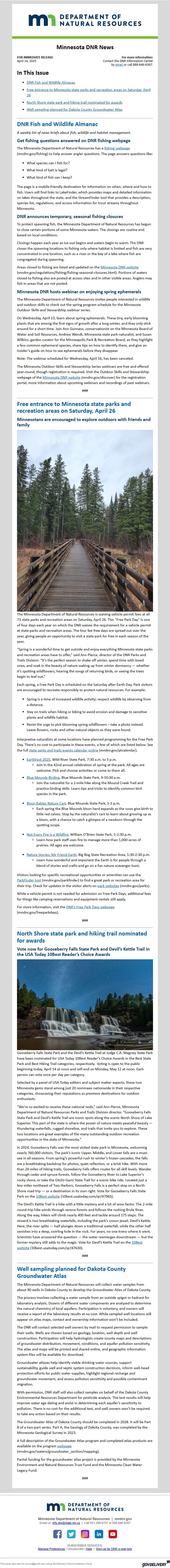
Free entrance to Minnesota state parks and recreation areas on Saturday, April 26
Minnesotans are encouraged to explore outdoors with friends and family
A bridge leading off into a forested area
The Minnesota Department of Natural Resources is waiving vehicle permit fees at all 73 state parks and recreation areas on Saturday, April 26. This “Free Park Day” is one of four days each year on which the DNR waives the requirement for a vehicle permit at state parks and recreation areas. The four fee-free days are spread out over the year, giving people an opportunity to visit a state park for free in each season of the year.
“Spring is a wonderful time to get outside and enjoy everything Minnesota state parks and recreation areas have to offer,” said Ann Pierce, director of the DNR Parks and Trails Division. “It’s the perfect season to shake off winter, spend time with loved ones, and soak in the beauty of nature waking up from winter dormancy — whether it’s spotting wildflowers, hearing the songs of returning birds, or seeing the trees begin to leaf out.”
Each spring, a Free Park Day is scheduled on the Saturday after Earth Day. Park visitors are encouraged to recreate responsibly to protect natural resources. For example:
* Spring is a time of increased wildlife activity; respect wildlife by observing from a distance.
* Stay on trails when hiking or biking to avoid erosion and damage to sensitive plants and wildlife habitat.
* Resist the urge to pick blooming spring wildflowers – take a photo instead. Leave flowers, rocks and other natural objects as they were found.
Interpretive naturalists at some locations have planned programming for the Free Park Day. There’s no cost to participate in these events, a few of which are listed below. See the full state parks and trails events calendar online [ [link removed] ] (mndnr.gov/ptcalendar).
* EarthFest 2025 [ [link removed] ], Wild River State Park, 7:30 a.m. to 5 p.m.
* Join in the 42nd annual celebration of spring at the park. All ages are welcome. Pick and choose activities or come to them all.
* Blue Mounds Birding [ [link removed] ], Blue Mounds State Park, 9-10:30 a.m.
* Join the naturalist for a 2-mile hike along the Mound Creek Trail and practice birding skills. Learn tips and tricks to identify common bird species in the park.
* Bison Babies Nature Cart [ [link removed] ], Blue Mounds State Park, 1-3 p.m.
* Each spring the Blue Mounds bison herd expands as the cows give birth to little red calves. Stop by the naturalist’s cart to learn about growing up as a bison, with a chance to catch a glimpse of a newborn through the spotting scope.
* Not Every Fire is a Wildfire [ [link removed] ], William O’Brien State Park, 1-2:30 p.m.
* Learn how park staff uses fire to manage more than 1,000 acres of prairies. All ages are welcome.
* Nature Stories: My Friend Earth [ [link removed] ], Big Bog State Recreation Area, 1:30-2:30 p.m.
* Learn how wonderful and important the Earth is for people through a blend of stories and crafts and go on a fun nature scavenger hunt.
Visitors looking for specific recreational opportunities or amenities can use the ParkFinder tool [ [link removed] ] (mndnr.gov/parkfinder) to find a great park or recreation area for their trip. Check for updates in the visitor alerts on park websites [ [link removed] ] (mndnr.gov/parks).
While a vehicle permit is not needed for admission on Free Park Days, additional fees for things like camping reservations and equipment rentals still apply.
For more information, visit the DNR’s Free Park Days webpage [ [link removed] ] (mndnr.gov/freeparkdays).
###
________________________________________________________________________
North Shore state park and hiking trail nominated for awards
Vote now for Gooseberry Falls State Park and Devil’s Kettle Trail in the USA Today 10Best Reader’s Choice Awards
A waterfall pours into a river with a starry sky in the background
Gooseberry Falls State Park and the Devil’s Kettle Trail at Judge C.R. Magney State Park have been nominated for USA Today 10Best Reader’s Choice Awards in the Best State Park and Best Hiking Trail categories, respectively. Voting is open to the public beginning today, April 14 at noon and will end on Monday, May 12 at noon. Each person can vote once per day per category.
Selected by a panel of USA Today editors and subject matter experts, these two Minnesota gems stand among just 20 nominees nationwide in their respective categories, showcasing their reputations as premiere destinations for outdoor enthusiasts.
“We’re so excited to receive these national nods,” said Ann Pierce, Minnesota Department of Natural Resources Parks and Trails Division director. “Gooseberry Falls State Park and Devil’s Kettle Trail are iconic spots along the scenic North Shore of Lake Superior. This part of the state is where the power of nature meets peaceful beauty — thundering waterfalls, rugged shoreline, and trails that invite you to explore. These two locations are great examples of the many outstanding outdoor recreation opportunities in the state of Minnesota.”
In 2024, Gooseberry Falls was the most visited state park in Minnesota, welcoming nearly 760,000 visitors. The park’s iconic Upper, Middle, and Lower falls are a must-see in all seasons. From spring’s powerful rush to winter’s frozen cascades, the falls are a breathtaking backdrop for photos, quiet reflection, or a brisk hike. With more than 20 miles of hiking trails, Gooseberry Falls offers routes for all skill levels. Wander through cedar and spruce forests, follow the Gooseberry River to Lake Superior’s rocky shore, or take the Gitchi-Gami State Trail for a scenic bike ride. Located just a few miles northeast of Two Harbors, Gooseberry Falls is a perfect stop on a North Shore road trip — or a destination in its own right. Vote for Gooseberry Falls State Park on the 10Best website [ [link removed] ] (10best.usatoday.com/qr/47965).
The Devil’s Kettle Trail is a hike with a little mystery and a lot of wow factor. The 2-mile round-trip hike winds through serene forests and follows the rushing Brule River. Along the way, hikers will climb nearly 400 feet and tackle around 175 steps. The reward is two breathtaking waterfalls, including the park’s crown jewel, Devil’s Kettle. Here, the river splits — half plunges down a traditional waterfall, while the other half vanishes into a deep, swirling hole in the rock. For years, no one knew where it went. Scientists have answered the question — the water reemerges downstream — but the former mystery still adds to the magic. Vote for Devil’s Kettle Trail on the 10Best website [ [link removed] ] (10best.usatoday.com/qr/47630).
###
________________________________________________________________________
Well sampling planned for Dakota County Groundwater Atlas
The Minnesota Department of Natural Resources will collect water samples from about 90 wells in Dakota County to develop the Groundwater Atlas of Dakota County.
The process involves collecting a water sample from an outside spigot or hydrant for laboratory analysis. Dozens of different water components are analyzed to determine the natural chemistry of local aquifers. Participation is voluntary, and owners will receive a report of the laboratory results at no cost. While sampled well locations will appear on atlas maps, contact and ownership information won’t be included.
The DNR will contact selected well owners by mail to request permission to sample their wells. Wells are chosen based on geology, location, well depth and well construction. Participation will help hydrologists create county maps and descriptions of groundwater distribution, movement, conditions, and aquifer pollution sensitivity. The atlas and maps will be printed and shared online, and geographic information system files will be available for download.
Groundwater atlases help identify viable drinking water sources, support sustainability, guide well and septic system construction decisions, inform well-head protection efforts for public water supplies, highlight regional recharge and groundwater movement, and assess pollution sensitivity and possible contaminant migration.
With permission, DNR staff will also collect samples on behalf of the Dakota County Environmental Resources Department for pesticide analysis. The test results will help improve water age dating and assist in determining each aquifer’s sensitivity to pollution. There is no cost for the additional test, and well owners won’t be required to take any action based on their results.
The Groundwater Atlas of Dakota County should be completed in 2028. It will be Part B of a two-part series. Part A, the Geology of Dakota County, was completed by the Minnesota Geological Survey in 2023.
A full description of the Groundwater Atlas program and completed atlas products are available on the program webpage [ [link removed] ] (mndnr.gov/waters/groundwater_section/mapping).
Partial funding for the groundwater atlas project is provided by the Minnesota Environment and Natural Resources Trust Fund and the Minnesota Clean Water Legacy Fund.
###
________________________________________________________________________
minnesota department of natural resources [ [link removed] ]
*Minnesota Department of Natural Resources | mndnr.gov [ [link removed] ] *
Email us: [email protected] | Call 651-296-6157 or 888-646-6367
Follow us on Facebook [ [link removed] ] Follow us on Twitter [ [link removed] ] Follow us on Instagram [ [link removed] ] Find us on LinkedIn [ [link removed] ] Follow us on YouTube [ [link removed] ]
SUBSCRIBER SERVICES:
Manage Preferences [ [link removed] ] | Unsubscribe [ [link removed] ] | Help [ [link removed] ] | Sign-up for DNR e-mail lists [ [link removed] ]
________________________________________________________________________
This email was sent to [email protected] using GovDelivery Communications Cloud GovDelivery logo [ [link removed] ]
body .abe-column-block { min-height: 5px; } table.gd_combo_table img {margin-left:10px; margin-right:10px;} table.gd_combo_table div.govd_image_display img, table.gd_combo_table td.gd_combo_image_cell img {margin-left:0px; margin-right:0px;}
header
*Minnesota DNR News
*
*FOR IMMEDIATE RELEASE
*
April 14, 2025
*For more information:* <[email protected]>
Contact the DNR Information Center
by email <[email protected]>or call 888-646-6367.
In This Issue
* DNR Fish and Wildlife Almanac [ #link_1491411839600 ]
* Free entrance to Minnesota state parks and recreation areas on Saturday, April 26 [ #link_1491411977526 ]
* North Shore state park and hiking trail nominated for awards [ #link_1491412003165 ]
* Well sampling planned for Dakota County Groundwater Atlas [ #link_1 ]
________________________________________________________________________
DNR Fish and Wildlife Almanac
"A weekly list of news briefs about fish, wildlife and habitat management."
Get fishing questions answered on DNR fishing webpage
The Minnesota Department of Natural Resources has a fishing webpage [ [link removed] ] (mndnr.gov/fishing) to help answer angler questions. The page answers questions like:
* What species can I fish for?
* What kind of bait is legal?
* What kind of fish can I keep?
The page is a mobile-friendly destination for information on when, where and how to fish. Users will find links to LakeFinder, which provides maps and detailed information on lakes throughout the state, and the StreamFinder tool that provides a description, species list, regulations, and access information for trout streams throughout Minnesota.
DNR announces temporary, seasonal fishing closures
To protect spawning fish, the Minnesota Department of Natural Resources has begun to close certain portions of some Minnesota waters. The closings are routine and based on local conditions.
Closings happen each year as ice-out begins and waters begin to warm. The DNR closes the spawning locations to fishing only where habitat is limited and fish are very concentrated in one location, such as a river or the bay of a lake where fish are congregated during spawning.
Areas closed to fishing are listed and updated on the Minnesota DNR website [ [link removed] ]_ _(mndnr.gov/regulations/fishing/fishing-seasonal-closures.html). Portions of waters closed to fishing also are posted at access sites and in other visible areas. Anglers may fish in areas that are not posted.
Minnesota DNR hosts webinar on enjoying spring ephemerals
The Minnesota Department of Natural Resources invites people interested in wildlife and outdoor skills to check out the spring program schedule for the Minnesota Outdoor Skills and Stewardship webinar series.
On Wednesday, April 23, learn about spring ephemerals. These tiny, early blooming plants that are among the first signs of growth after a long winter, and they only stick around for a short time. Join Ann Gunness, conservationist on the Minnesota Board of Water and Soil Resources, Andrew Wendt, Minnesota state park naturalist, and Susan Wilkins, garden curator for the Minneapolis Park & Recreation Board, as they highlight a few common ephemeral species, share tips on how to identify them, and give an insider’s guide on how to see ephemerals before they disappear.
Note: The webinar scheduled for Wednesday, April 16, has been canceled.
The Minnesota Outdoor Skills and Stewardship Series webinars are free and offered year-round, though registration is required. Visit the Outdoor Skills and Stewardship webpage of the Minnesota DNR website [ [link removed] ] (mndnr.gov/discover) for the registration portal, more information about upcoming webinars and recordings of past webinars.
###
________________________________________________________________________
Free entrance to Minnesota state parks and recreation areas on Saturday, April 26
Minnesotans are encouraged to explore outdoors with friends and family
A bridge leading off into a forested area
The Minnesota Department of Natural Resources is waiving vehicle permit fees at all 73 state parks and recreation areas on Saturday, April 26. This “Free Park Day” is one of four days each year on which the DNR waives the requirement for a vehicle permit at state parks and recreation areas. The four fee-free days are spread out over the year, giving people an opportunity to visit a state park for free in each season of the year.
“Spring is a wonderful time to get outside and enjoy everything Minnesota state parks and recreation areas have to offer,” said Ann Pierce, director of the DNR Parks and Trails Division. “It’s the perfect season to shake off winter, spend time with loved ones, and soak in the beauty of nature waking up from winter dormancy — whether it’s spotting wildflowers, hearing the songs of returning birds, or seeing the trees begin to leaf out.”
Each spring, a Free Park Day is scheduled on the Saturday after Earth Day. Park visitors are encouraged to recreate responsibly to protect natural resources. For example:
* Spring is a time of increased wildlife activity; respect wildlife by observing from a distance.
* Stay on trails when hiking or biking to avoid erosion and damage to sensitive plants and wildlife habitat.
* Resist the urge to pick blooming spring wildflowers – take a photo instead. Leave flowers, rocks and other natural objects as they were found.
Interpretive naturalists at some locations have planned programming for the Free Park Day. There’s no cost to participate in these events, a few of which are listed below. See the full state parks and trails events calendar online [ [link removed] ] (mndnr.gov/ptcalendar).
* EarthFest 2025 [ [link removed] ], Wild River State Park, 7:30 a.m. to 5 p.m.
* Join in the 42nd annual celebration of spring at the park. All ages are welcome. Pick and choose activities or come to them all.
* Blue Mounds Birding [ [link removed] ], Blue Mounds State Park, 9-10:30 a.m.
* Join the naturalist for a 2-mile hike along the Mound Creek Trail and practice birding skills. Learn tips and tricks to identify common bird species in the park.
* Bison Babies Nature Cart [ [link removed] ], Blue Mounds State Park, 1-3 p.m.
* Each spring the Blue Mounds bison herd expands as the cows give birth to little red calves. Stop by the naturalist’s cart to learn about growing up as a bison, with a chance to catch a glimpse of a newborn through the spotting scope.
* Not Every Fire is a Wildfire [ [link removed] ], William O’Brien State Park, 1-2:30 p.m.
* Learn how park staff uses fire to manage more than 1,000 acres of prairies. All ages are welcome.
* Nature Stories: My Friend Earth [ [link removed] ], Big Bog State Recreation Area, 1:30-2:30 p.m.
* Learn how wonderful and important the Earth is for people through a blend of stories and crafts and go on a fun nature scavenger hunt.
Visitors looking for specific recreational opportunities or amenities can use the ParkFinder tool [ [link removed] ] (mndnr.gov/parkfinder) to find a great park or recreation area for their trip. Check for updates in the visitor alerts on park websites [ [link removed] ] (mndnr.gov/parks).
While a vehicle permit is not needed for admission on Free Park Days, additional fees for things like camping reservations and equipment rentals still apply.
For more information, visit the DNR’s Free Park Days webpage [ [link removed] ] (mndnr.gov/freeparkdays).
###
________________________________________________________________________
North Shore state park and hiking trail nominated for awards
Vote now for Gooseberry Falls State Park and Devil’s Kettle Trail in the USA Today 10Best Reader’s Choice Awards
A waterfall pours into a river with a starry sky in the background
Gooseberry Falls State Park and the Devil’s Kettle Trail at Judge C.R. Magney State Park have been nominated for USA Today 10Best Reader’s Choice Awards in the Best State Park and Best Hiking Trail categories, respectively. Voting is open to the public beginning today, April 14 at noon and will end on Monday, May 12 at noon. Each person can vote once per day per category.
Selected by a panel of USA Today editors and subject matter experts, these two Minnesota gems stand among just 20 nominees nationwide in their respective categories, showcasing their reputations as premiere destinations for outdoor enthusiasts.
“We’re so excited to receive these national nods,” said Ann Pierce, Minnesota Department of Natural Resources Parks and Trails Division director. “Gooseberry Falls State Park and Devil’s Kettle Trail are iconic spots along the scenic North Shore of Lake Superior. This part of the state is where the power of nature meets peaceful beauty — thundering waterfalls, rugged shoreline, and trails that invite you to explore. These two locations are great examples of the many outstanding outdoor recreation opportunities in the state of Minnesota.”
In 2024, Gooseberry Falls was the most visited state park in Minnesota, welcoming nearly 760,000 visitors. The park’s iconic Upper, Middle, and Lower falls are a must-see in all seasons. From spring’s powerful rush to winter’s frozen cascades, the falls are a breathtaking backdrop for photos, quiet reflection, or a brisk hike. With more than 20 miles of hiking trails, Gooseberry Falls offers routes for all skill levels. Wander through cedar and spruce forests, follow the Gooseberry River to Lake Superior’s rocky shore, or take the Gitchi-Gami State Trail for a scenic bike ride. Located just a few miles northeast of Two Harbors, Gooseberry Falls is a perfect stop on a North Shore road trip — or a destination in its own right. Vote for Gooseberry Falls State Park on the 10Best website [ [link removed] ] (10best.usatoday.com/qr/47965).
The Devil’s Kettle Trail is a hike with a little mystery and a lot of wow factor. The 2-mile round-trip hike winds through serene forests and follows the rushing Brule River. Along the way, hikers will climb nearly 400 feet and tackle around 175 steps. The reward is two breathtaking waterfalls, including the park’s crown jewel, Devil’s Kettle. Here, the river splits — half plunges down a traditional waterfall, while the other half vanishes into a deep, swirling hole in the rock. For years, no one knew where it went. Scientists have answered the question — the water reemerges downstream — but the former mystery still adds to the magic. Vote for Devil’s Kettle Trail on the 10Best website [ [link removed] ] (10best.usatoday.com/qr/47630).
###
________________________________________________________________________
Well sampling planned for Dakota County Groundwater Atlas
The Minnesota Department of Natural Resources will collect water samples from about 90 wells in Dakota County to develop the Groundwater Atlas of Dakota County.
The process involves collecting a water sample from an outside spigot or hydrant for laboratory analysis. Dozens of different water components are analyzed to determine the natural chemistry of local aquifers. Participation is voluntary, and owners will receive a report of the laboratory results at no cost. While sampled well locations will appear on atlas maps, contact and ownership information won’t be included.
The DNR will contact selected well owners by mail to request permission to sample their wells. Wells are chosen based on geology, location, well depth and well construction. Participation will help hydrologists create county maps and descriptions of groundwater distribution, movement, conditions, and aquifer pollution sensitivity. The atlas and maps will be printed and shared online, and geographic information system files will be available for download.
Groundwater atlases help identify viable drinking water sources, support sustainability, guide well and septic system construction decisions, inform well-head protection efforts for public water supplies, highlight regional recharge and groundwater movement, and assess pollution sensitivity and possible contaminant migration.
With permission, DNR staff will also collect samples on behalf of the Dakota County Environmental Resources Department for pesticide analysis. The test results will help improve water age dating and assist in determining each aquifer’s sensitivity to pollution. There is no cost for the additional test, and well owners won’t be required to take any action based on their results.
The Groundwater Atlas of Dakota County should be completed in 2028. It will be Part B of a two-part series. Part A, the Geology of Dakota County, was completed by the Minnesota Geological Survey in 2023.
A full description of the Groundwater Atlas program and completed atlas products are available on the program webpage [ [link removed] ] (mndnr.gov/waters/groundwater_section/mapping).
Partial funding for the groundwater atlas project is provided by the Minnesota Environment and Natural Resources Trust Fund and the Minnesota Clean Water Legacy Fund.
###
________________________________________________________________________
minnesota department of natural resources [ [link removed] ]
*Minnesota Department of Natural Resources | mndnr.gov [ [link removed] ] *
Email us: [email protected] | Call 651-296-6157 or 888-646-6367
Follow us on Facebook [ [link removed] ] Follow us on Twitter [ [link removed] ] Follow us on Instagram [ [link removed] ] Find us on LinkedIn [ [link removed] ] Follow us on YouTube [ [link removed] ]
SUBSCRIBER SERVICES:
Manage Preferences [ [link removed] ] | Unsubscribe [ [link removed] ] | Help [ [link removed] ] | Sign-up for DNR e-mail lists [ [link removed] ]
________________________________________________________________________
This email was sent to [email protected] using GovDelivery Communications Cloud GovDelivery logo [ [link removed] ]
body .abe-column-block { min-height: 5px; } table.gd_combo_table img {margin-left:10px; margin-right:10px;} table.gd_combo_table div.govd_image_display img, table.gd_combo_table td.gd_combo_image_cell img {margin-left:0px; margin-right:0px;}
Message Analysis
- Sender: Minnesota Department of Natural Resources
- Political Party: n/a
- Country: United States
- State/Locality: Minnesota
- Office: n/a
-
Email Providers:
- govDelivery